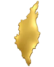
THE ISLANDS. THE PEOPLE. THE POSSIBILITIES.
Explore Zanzibar
Two main islands.
A world of places to discover.
Get to know Unguja, Pemba and the smaller islands around them — from historic streets and working coastal communities to coral reefs and protected forests.
Explore Interactive MapAN OFFICIAL STARTING POINT
Zanzibar at a glance
An island region of Tanzania
Zanzibar forms part of the United Republic of Tanzania. Unguja is often called Zanzibar Island; Pemba is the other main island. Zanzibar City is on Unguja, with Stone Town as its historic centre.
This guide covers Zanzibar’s islands only. Locations shown on the map are destinations, not administrative boundaries or land parcels.
Culture, coast & nature
Swahili heritage, Indian Ocean trade, spice traditions, coastal livelihoods and marine biodiversity shape the islands. Unguja combines the city with established beach destinations; Pemba offers a different landscape and island rhythm.
Protected reefs, forests and historic areas have their own management requirements. A place featured here is not a claim that land is available for investment.
Facts reviewed 19 September 2026. Population is the census count, not a current estimate. Area is quoted on the basis used in the named NBS publication; other publications may use different area definitions. Explore the Zanzibar Commission for Tourism’s official information ↗
FIND YOUR PLACE IN ZANZIBAR
Explore Interactive Map
Select a destination to see its location, photograph and local context.
A closer look at the islands
Load the interactive map to pan, zoom and locate each destination.
The map is provided by OpenStreetMap. Loading it shares your IP address and technical request data with that service. Map & privacy information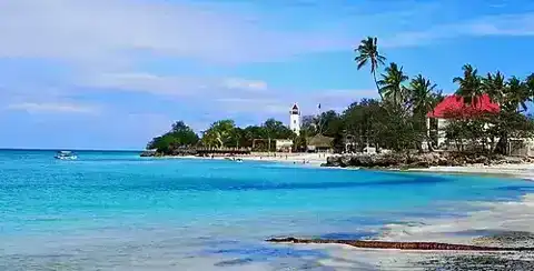
Unguja
Unguja
Zanzibar’s largest island brings together the historic city, coastal communities and beach destinations.
Read the source ↗Pins indicate approximate destination centres, not plot boundaries. Map data © OpenStreetMap contributors. Photographs show the named location or the nearby area stated in the caption; they are not live images.
A guide to the islands
Unguja
Zanzibar’s largest island brings together the historic city, coastal communities and beach destinations. Explore its north, east and southwest coasts to understand how each area differs.
Destination source ↗Stone Town
The historic heart of Zanzibar City is a UNESCO World Heritage Site. Its narrow streets and buildings reflect centuries of Swahili and Indian Ocean exchange. Heritage conservation is central to any project here.
Destination source ↗Nungwi
At Unguja’s northern tip, Nungwi combines a coastal settlement with visitor accommodation, boatbuilding traditions and marine activities. The shoreline offers a different setting from the island’s east coast.
Destination source ↗Paje
Paje lies on Unguja’s southeast coast. Its beach and lagoon are known for kite sports, alongside village life and visitor services. Tides and seasonal wind conditions shape activity along this coast.
Destination source ↗Jambiani
South of Paje, Jambiani is a coastal village area where seaweed farming and fishing sit alongside beach tourism. Local livelihoods and the tidal shoreline are an important part of its character.
Destination source ↗Fumba & Menai Bay
Fumba sits on the southwest peninsula of Unguja, overlooking the Menai Bay area. Marine conservation, fishing communities and access to Zanzibar City are important parts of this setting.
Destination source ↗Jozani Forest
Jozani is a forest and wildlife destination in southern Unguja, known for the Zanzibar red colobus. Forest and mangrove habitats make conservation and environmental education central to a visit.
Destination source ↗Pemba Island
Zanzibar’s other main island lies north of Unguja. Coastal scenery, agricultural landscapes and towns such as Chake Chake offer a distinct island experience. Explore Pemba’s heritage and surrounding marine environment.
Destination source ↗Misali Island
West of Pemba, Misali is associated with coral reefs, forest and community livelihoods. Its marine conservation setting calls for careful visitor management and respect for protected habitats.
Destination source ↗Chumbe Island
Off southwest Unguja, Chumbe is known for coral-reef conservation, environmental education and eco-tourism. The protected island and reef are a conservation destination rather than an open development site.
Destination source ↗Changuu Island
Also known as Prison Island, Changuu lies off Zanzibar City’s western coast. It is a small island destination visited on boat excursions from Stone Town.
Destination source ↗Mnemba Island
Off northeastern Unguja, Mnemba sits within a marine conservation setting with coral habitats and turtle nesting. Access to the island and activities in its surrounding waters are subject to the relevant rules.
Destination source ↗Photography credits & licences
- Stone Town waterfront and Sultan’s Palace — No machine-readable author provided. Mbz1 assumed (based on copyright claims).. Original photograph · CC BY-SA 3.0. Resized and compressed.
- Nungwi waterfront — Sansibar-freundeskreis.de. Original photograph · CC BY-SA 4.0. Resized and compressed.
- Beach life in Paje — Cécile Furet. Original photograph · CC BY-SA 4.0. Resized and compressed.
- Seaweed harvesting in Jambiani — Yann Macherez. Original photograph · CC BY-SA 4.0. Resized and compressed.
- Nearby Menai Bay: a small island near Kwale — lazyweaver. Original photograph · CC BY 3.0. Resized and compressed.
- Zanzibar red colobus in Jozani Chwaka Bay National Park — Mnazini. Original photograph · CC BY 4.0. Resized and compressed.
- Vumawimbi Beach, Pemba — Marcel Oosterwijk from Amsterdam, The Netherlands. Original photograph · CC BY-SA 2.0. Resized and compressed.
- Octopus drying on Misali Island — Wikimedia contributor. Original photograph · CC BY-SA 3.0. Resized and compressed.
- Chumbe Island buildings — archival photograph, 1985 — mwanasimba from La Réunion. Original photograph · CC BY-SA 2.0. Resized and compressed.
- Buildings on Changuu Island — Mangapwani. Original photograph · CC BY-SA 4.0. Resized and compressed.
- Mnemba Island seen from the sea — Oogstweg. Original photograph · CC BY-SA 4.0. Resized and compressed.


.jpg)


From a place to a project.
Explore published opportunities or connect with local partners.